RS Metrics Announces Expansion into Bulk Commodities Coverage through Partnership with ICEYE
RS Metrics, the leading company for satellite-imagery derived analytics and trading signals for ESG, metal equities, global supply trends, and price forecast
This dataset will be available through RS Metrics and its partners including CME, Bloomberg, SGX Singapore, SMM, Nasdaq / Quandl. RS Metrics and ICEYE also announced their intention to exploring their expansion into energy markets by covering coal inventories globally through SAR.
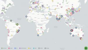
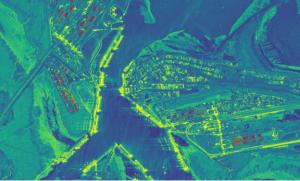
MetalSignals™ interprets satellite imagery through advanced AI and machine-learning models to generate timely measures of global metals stockpiles from over 500 smelters, refineries, terminals, mines, and storage facilities. ICEYE SAR satellites form a constellation that enables unmatched imaging revisit rates on a global scale. Specifically, ICEYE will provide RS Metrics multi-angle SAR satellite imaging to cover the global iron ore supply chain. In addition, RS Metrics will be able to track supply disruptions and quantify the impact more frequently through the ICEYE constellation. As the ICEYE SAR Constellation grows, it will provide RS Metrics MetalSignals™ previously unavailable imaging capabilities and access, allowing quick tactical acquisitions as well as frequent global revisit rates.
By introducing SAR MetalSignals™, quantitative and fundamental analysts, traders, and portfolio managers will now have access to here-to unavailable iron-ore inventories information to predict metals commodity futures prices and model associated movements in equities, currencies, and foreign exchange prices.
"RS Metrics' patented and market leading PAAS platform has always been at the cutting edge of geo-spatial analytics" said Maneesh Sagar, CEO of RS Metrics. "Our partnership with ICEYE allows us to address customer's key pain-points around optical imagery data - reliability and frequency - because radar imaging makes it possible for us to track locations through clouds and even in total darkness, we can now provide our customers with unprecedented access to the data."
"Moreover, as the world's forerunner in small SAR satellites, ICEYE's mission aligns closely with that of RS Metrics, which pioneered the geo-spatial data analytics market in 2010 as reported by CNBC. We are always excited to provide our customers access to disruptive new technologies that enhance their modelling and analysis, and our partnership with ICEYE fulfills that promise."
About RS Metrics:
Founded in 2010, RS Metrics analyzes and derives data from satellite and aerial imagery to provide fundamental insights, trends, and predictive signals for businesses and investors in metals, industrials, retail, and commercial real estate. RS Metrics' proprietary, patented technology platform leverages advanced computer vision and machine learning and a scaled quality control workflow to generate accurate, predictive, and consumable information.
Data is available in easy-to-use end-user applications, signals, and tools, and as daily data feeds for customers with quantitative focus and capabilities. For more information, visit https://www.rsmetrics.com or contact Maneesh Sagar at msagar@rmetrics.com. Follow us on Twitter, Linkedin and Facebook
Other Products Offered by RS Metrics:
ESGSignals™:
RS Metrics' ESGSignals™ provides objective, environmental insights and benchmarks from satellite analytics on a weekly basis and covers 1000s of companies and industrial locations around the globe. Objective measurements on ESG factors such as green energy usage, land reclamation, new construction on site, proximity to water bodies and many more are monitored regularly via remote sensing imagery. Wherever applicable, the production and outdoor storage levels are also measured and delivered as part of ESG raw data. For more information visit: https://www.esgsignals.com
TrafficSignals™:
The scarcity of Interesting, Insightful and Clean real-world data sets for academic research has been an issue for the academic community for so long. Here we come to your rescue with multiple rare-to-find, market verified, clean data sets with highly accurate observations. TrafficSignals™ contains parking lot traffic data (vehicle counts) at parking lots and the actual parking lot size for 65000+ retail store locations around the United States covering around 52 major retail tickers. A few out of the 52 tickers: WMT (Walmart), HD (Home Depot), LOW (Lowes), BBY (Best Buy), PNRA (Panera) etc. Each location was monitored with a multiple times a month frequency.
Custom Monitoring:
RS Metrics’ capabilities for custom monitoring include historical and go-forward analysis for one or multiple locations. RS Metrics works with the world’s leading satellite, aerial, and drone platforms to select the best combination of data available for any project. In addition to imagery collection, RS Metrics’ custom monitoring service includes data extraction and analytics development using cloud-based human/machine platform
GREAT (Global real-time monitoring and alert system):
GREAT is a customer dashboard and alert system that is custom made for each organization to meet their specific needs. GREAT provides not just measurements, but also real-time alerts. RS Metrics’ platform can track and measure activity and change at thousands of locations such as factories, retail sites, mines, and critical infrastructure. Using RS Metrics’ AI platform trained with more than 6 years of historical data, GREAT can be used to monitor supply chain, productivity, and competition
About ICEYE:
ICEYE is building and operating its own commercial constellation of SAR satellites, with SAR data already available to customers. ICEYE empowers others to make better decisions in governmental and commercial industries by providing access to timely and reliable radar satellite imagery. The company is tackling the current crucial lack of actionable information with world-first aerospace capabilities and a New Space approach. ICEYE's radar satellite imaging service, designed to deliver coverage every few hours, both day and night, helps clients resolve challenges in sectors such as maritime, disaster management, insurance, and finance. For more information, please visit: https://www.iceye.com
Maneesh Sagar
RS Metrics LLC
+1 646-504-7594
email us here
Visit us on social media:
Facebook
Twitter
LinkedIn
Legal Disclaimer:
EIN Presswire provides this news content "as is" without warranty of any kind. We do not accept any responsibility or liability for the accuracy, content, images, videos, licenses, completeness, legality, or reliability of the information contained in this article. If you have any complaints or copyright issues related to this article, kindly contact the author above.


