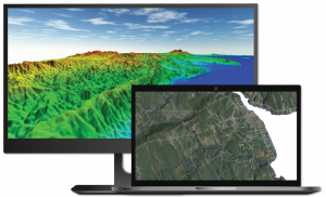
Blue Marble Geographics releases the Global Mapper version 23 and Global Mapper Pro Software Development Kits
Providing developers with access to Global Mapper Pro functionality, the Blue Marble software development kits are updated to include new tools and features.
Both software development kits allow developers to utilize functionality from Global Mapper in their own applications and create custom toolbars and extensions for the latest versions of Global Mapper including support for Python scripting.
Enhancing the 3D visualization of data through the Global Mapper engine, text labels for vector features can now be displayed using styles created specifically for 3D rendering. In addition, the latest version of the SDK now includes spatial operations functionality for comparing and analyzing vector features with operations such as intersect, overlap, and union, among others. This spatial operation functionality is now available for all vector feature sets including point, line, and area geometries.
Congruent with the introduction of Global Mapper Pro, the Lidar SDK is replaced with the Global Mapper Pro SDK. The Pro version SDK unlocks the previously available lidar functionality, and extends the toolset to include new advanced features for terrain analysis, workflow optimization, and more. New lidar classification processes utilize the latest segmentation methods to better handle mixed density, terrestrial, and photo-derived point clouds. To streamline and automate workflows, new Python integration supports the creation and execution of scripts written in the Python programming language when combined with the Global Mapper Pro application.
“The addition of segmented lidar processing, along with new spatial operations methods will allow Global Mapper Pro SDK customers easier access to very large datasets, and provide much higher fidelity data processing workflows. Pairing all of this functionality with the Global Mapper Pro application and Python based programming tools they may already be familiar with will be a popular feature for all of our customers,” stated Sam Knight, Director of Product Management, “We’re excited to see what our developer customers do with this new way of working with the SDK.”
With opportunities to use the engine behind Global Mapper in custom applications and tools, the Blue Marble software development kits prove to be a valuable resource for organizations worldwide.
To download a trial of the Global Mapper SDK, visit the Blue Marble Geographics website bluemarblegeo.com/global-mapper-sdk. For any questions or to request a trial of the Global Mapper Pro SDK, please contact sales@bluemarblegeo.com.
###
As a leader in GIS and software development, Blue Marble Geographics® provides professional-grade tools to GIS users at every level. Founded in 1993, Blue Marble’s expertise spans the geospatial technology sector with particular focus on coordinate conversion and management, lidar and photogrammetric point cloud processing, and user-driven product development.
Blue Marble’s products include Geographic Calculator®, the industry standard for precise spatial data conversion and advanced coordinate system management; Global Mapper®, an all-in-one GIS application with a comprehensive array of data processing and analysis tools; and Global Mapper Pro®, a suite of advanced tools for optimizing workflow efficiency, and processing lidar and photogrammetric point clouds from drone-captured images. All of these desktop tools are also available as software developer toolkits and libraries.
For nearly three decades, Blue Marble’s products have been used and trusted by organizations around the globe — including government agencies, universities, and Fortune 500 companies. For more information visit: www.bluemarblegeo.com
Cintia Miranda
Blue Marble Geographics
+1 207-622-4622
cintiam@Bluemarblegeo.com
Visit us on social media:
Facebook
Twitter
LinkedIn
Legal Disclaimer:
EIN Presswire provides this news content "as is" without warranty of any kind. We do not accept any responsibility or liability for the accuracy, content, images, videos, licenses, completeness, legality, or reliability of the information contained in this article. If you have any complaints or copyright issues related to this article, kindly contact the author above.

