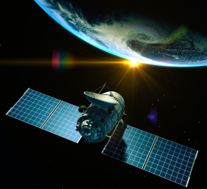
Why are utilities choosing satellites over drones and LiDAR for their O&M needs?
AiDash is working with several Fortune 500 utility companies to drive efficient vegetation management using satellite analytics
SANTA CLARA, CALIFORNIA, UNITED STATES, February 5, 2021 /EINPresswire.com/ -- 2020 was one of the most destructive years for electric utilities in the state. Last year saw a series of large-scale weather events that ravaged utility infrastructure and caused massive power outages affecting millions of people across the country. Trees damaged power lines and caused outages all along the way. Response and post-restoration work was a nightmare for utility companies.
Managing vegetation around power lines has always been a challenge for electric utilities, but it gets worse when disasters strike. Tropical storms, hurricanes, wildfires, blizzards and other such weather events are only getting more intense, thanks to climate change. In such a scenario, utilities must look at making foolproof plans for better vegetation management along with disaster preparedness.
To help utilities better manage vegetation around their Transmission and Distribution lines, AiDash — a San Francisco Bay Area-based AI-first SaaS company — has designed a satellite-powered model called the Intelligent Vegetation Management System (IVMS). AiDash IVMS is a dedicated SaaS product for vegetation management that uses high-resolution multispectral and SAR data to remotely monitor and survey vegetation around T&D lines. AiDash IVMS uses a combination of AI models that convert satellite data into actionable insights for determining clearance and growth rate along power lines both inside and outside the Rights of Way.
However, there’s been a debate on why satellites are being preferred when utilities were being able to carry out vegetation-related O&M via drones and LiDAR. To which, Abhishek Vinod Singh, CEO of AiDash said, “Drones and LiDAR have long failed to yield results for utilities. Not only are these technologies extremely costly, they have massive limitations starting from geographical coverage to compliance issues. On the other hand, satellite technology combined with AI is offering a lot more in 10 times lower the costs.” He added, “AiDash Intelligent Vegetation Management System is the world’s only satellite-powered vegetation management system deployed at scale for large utilities.”
Utilities spend millions of dollars each year on vegetation management. Drones and LiDAR have been used so far for such endeavors, but their results were neither satisfactory nor worth the massive effort, time and extensive expenses that were put into them. Their biggest disadvantage is that due to the labor-intensive process of collecting the data, the costs are very high; this would typically include aircraft, employment costs and equipment. Another pressing issue is that constant monitoring is not possible, and there is a gap between data updates, which can often be anything between 5 to 10 years. And then there are regulatory compliance requirements that cost time, effort and resources.
Meanwhile, satellites have completely revolutionized the vegetation management space. With their groundbreaking technology, they provide accurate, weather-independent imagery (SAR-equipped satellites can easily penetrate clouds, no matter how bad weather conditions might be) and their geographic coverage wavelength is the entire planet. They can store historical data that can be used whenever necessary and improve ground-based efficiency and targeting, so you only visit the relevant areas, hugely cutting down on costs.
AiDash is pioneering this revolution with IVMS and is already working with several Fortune 500 power utilities to provide them with 360-degree visibility of their infrastructure and vegetation growth along the RoW. Here's an interesting infographic on why Satellites are in and Drones & LiDAR are out for electric utilities' O&M needs.
To know more or to connect with an AiDash representative, please mail at info@aidash.com.
About AiDash
AiDash is an AI-first vertical SaaS company enabling satellite-powered operations and maintenance for utility, energy, and other core industries with geographically distributed assets. AiDash uses high-resolution, multispectral and SAR data from the world’s leading satellite constellations that are fed into its proprietary AI models to make timely predictions for O&M activities. These AI models empower AiDash’s full-stack applications and enable efficient planning, prioritization, execution, review and audit of O&M activities using satellite analytics. Visit aidash.com.
Bradley Smith
AiDash Inc
+1 408-703-1099
email us here
Visit us on social media:
Facebook
Twitter
LinkedIn
About Intelligent Vegetation Management System

