Global Geospatial Institute Celebrates the Explosion of Geospatial Technology at Virtual Louisiana GIS Day November 18
Universities, government agencies, schools, nonprofits, and GIS professionals share their global progress using GIS technology to inspire future innovators.
We know that by offering a GIS Industry-Based Certification, we can develop students into lifelong learners who will be able to live, compete, and successfully function in a global society.”
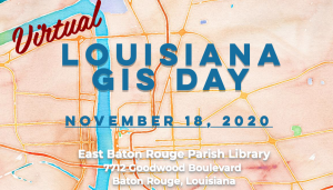
BATON ROUGE, LOUISIANA, UNITED STATES, November 13, 2020 /EINPresswire.com/ -- Global Geospatial Institute (GGI) will celebrate Louisiana GIS Day on Wednesday, November 18, 2020. While global circumstances require GIS Day to be virtual this year, GGI will celebrate innovative applications of geographic information system (GIS) technology in analysis, visualization, gaining insights into geospatial data, and thought leadership in the field of K-12 Education.— Fran Harvey
On November 18, GGI will join hundreds of organizations worldwide in hosting virtual gatherings that will celebrate the impactful work of GIS professionals and serve to ignite the imagination of the future innovators who will further advance global progress using GIS. GGI is partnering with Baton Rouge Green and Louisiana Community of Forests, as well as the East Baton Rouge Parish Library and City of Baton Rouge Parish of East Baton Rouge to make Louisiana GIS Day possible.
“GIS Day is not just an event. It's a global movement. This day brings universities, government agencies, schools, nonprofits, and GIS professionals together to build knowledge and understanding of GIS technology to their communities so that everyone can share in a better understanding about the world we live in,” said Fran Harvey, Director of GGI. “At GGI, we teach students to learn and acquire GIS skills to gain employment right out of high school. We know that by offering a GIS Industry-Based Certification, we can develop students into lifelong learners who will be able to live, compete, and successfully function in a global society. We also train teachers virtually to enhance their current curriculum by providing GIS resources that they can incorporate in their everyday teaching.” For more information on how GGI is reimagining education through GIS applications, visit gginstitute.org.
History of GIS Day
Over 20 years ago, Jack Dangermond, the founder and president of Esri, envisioned people collaborating and sharing how GIS affects everyone. This led to the establishment of GIS Day, which was first observed in 1999. The explosion of geospatial technology since then has expanded that idea into a global event that shows how geography and the real-world applications of GIS are making a difference in business, government, and society. It's a chance for organizations to share their accomplishments and inspire others to discover and use GIS. "GIS Day is a wonderful opportunity for professionals from around the world to get together to share the amazing things they are doing," said Dangermond. "This year, more than ever before, the work of GIS has helped the world better understand and mitigate the impacts of COVID-19. Organizations across the globe are taking part in grassroots events that help celebrate geospatial science and how it impacts the real world for good. Our users should be proud of the work they do, which GIS Day is meant to showcase."
About Global Geospatial Institute
Global Geospatial Institute (GGI) provides parents, students, and teachers the support they need to succeed in the field of study, geospatial technology. By offering spatial education through state-of-the-art technology, GGI strives to put Geographic Information System (GIS) and Remote Sensing (RS) technology in the hands of as many students as it can.
By utilizing hands-on project-based learning, real-world problem solving, and service-learning, GGI aims to provide students with a future career track. GGI starts by introducing GIS to K-12, especially middle school students, in a variety of ways. High school students can then register for a GIS course to ultimately obtain a GIS IBC (Industry-Based Certification). Recently, the GIS IBC has been promoted into eleven (11) Jump Start 2.0 Pathways; to name a few, Manufacturing Construction Crafts and Logistics Pathway and Environmental Protection and Sustainability Pathway. Global Geospatial Institute is the only industry accredited program in the State of Louisiana that prepares high school students and lifelong learners with the tools they need to advance in workforce development and compete in a global job market. Learn more at gginstitute.org
About Esri
Esri, the global market leader in geographic information system (GIS) software, location intelligence, and mapping, offers the most powerful geospatial cloud available, to help customers unlock the full potential of data to improve operational and business results. Founded in 1969, Esri software is deployed in more than 350,000 organizations including 90 of the Fortune 100 companies, all 50 state governments, more than half of all counties (large and small), and 87 of the Forbes Top 100 Colleges in the U.S., as well as all 15 Executive Departments of the U.S. Government and dozens of independent agencies. With its pioneering commitment to geospatial information technology, Esri engineers the most advanced solutions for digital transformation, the Internet of Things (IoT), and advanced analytics. Visit us at esri.com.
Copyright © 2020 Esri. All rights reserved. Esri, the Esri globe logo, The Science of Where, esri.com, and @esri.com are trademarks, service marks, or registered marks of Esri in the United States, the European Community, or certain other jurisdictions. Other companies and products or services mentioned herein may be trademarks, service marks, or registered marks of their respective mark owners.
Fran Harvey
Global Geospatial Institute
+1 225-939-1091
email us here
Visit us on social media:
Facebook
LinkedIn
Make every day "GIS Day"


